20220310
March 2, 2022 Arahama District, Sendai
Around noon, we went to the Arahama Elementary School, which has become the tsunami ruins and has been open to the public since 2016. It is incredibly windy.
We took a bus from the nearest station, Arai Station, to the elementary school. On the way, there are fields and rice paddies, and not a lot of people around. At the last stop, Arahama Elementary School, there were a few visitors, probably because it was March when the Great East Japan Earthquake occurred in 2011.
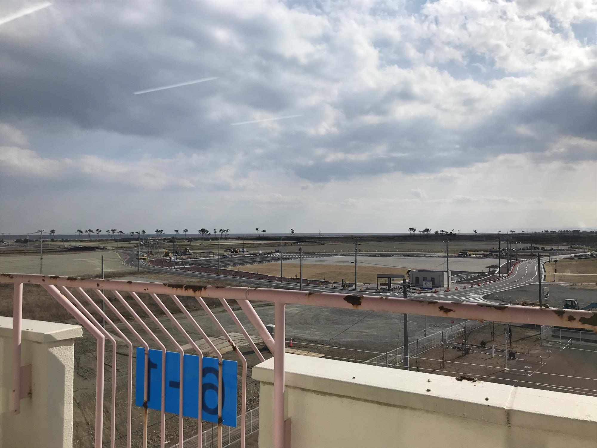
The surrounding area is not allowed to be inhabited as a disaster risk zone, so a reuse plan was being considered and the construction is underway. The plan is to develop the area into a park that can be used by citizens and tourists after interviews with the residents. In addition to the Arahama Elementary School, the foundations of houses remain as earthquake ruins, and other facilities such as an assembly hall, a playground, and a fruit park that can be used by local residents and tourists are scattered throughout the area.
Each facility is 1 km or more away from the other. Even though the neighborhood is densely packed, people are supposed to drive around, and no one walks. Construction work to clear the land and improve the roads was being carried out at a leisurely pace. There seems to be a tree-planting project underway, but the trees are not yet large, and there is a loneliness that is rather emphasized by the empty situation: cleared ground, grassy hills, and so on.
Inside the Arahama Elementary School, the first and second floors, which were heavily damaged by the tsunami, retain their original conditions, and the fourth floor, where residents evacuated, is used as an exhibition of materials. In the classrooms, there was a large model about 3.6 square meter, with various plots of the points of the town as it once was. It was densely populated, showing that there was indeed human activity here. There were about 800 houses in the area, but the model was more telling than the number of houses. The distance from the site, which can only be reached by car, may not give the land the scent of human activity.
From what I have seen in the news, utilization of the land seems to be a problem in many areas affected by the disaster. Indeed, looking at the current state of the land after maintenance, there is no indication that “people used to live here. ” Even in the corner where the foundations of the damaged houses are still standing tell us the power of the tsunami, but the surrounding area is empty. I was a bit baffled as to how to perceive this scene.
The levee on the ocean side is covered with sand due to strong winds. Since the sea cannot be seen from inside the levee, combined with the strong winds, it looks as if I am on a sand dune. Once, when I traveled to the Moroccan desert, I had a terrible experience with an annual sandstorm. It reminded me a little of that experience, and I am not quite sure where I am.
However, I was told by a staff at the meeting place where I took a break that it is only particularly windy at this time of year, and that a pleasant breeze changes direction throughout the year (this is the local characteristic “inasa,” which has been featured in a program on NHK). I was just hit again by the violent winds of early spring.
Parallel to the coastline is the Teizan moat, created by the Date clan in the Edo period. There, ducks and seagulls were gathering to shelter from the wind. A peaceful scene. I wonder who is using this place comfortably now. Animals spending their time relaxing, plants growing slowly, and the construction work progressing at a leisurely pace. The earth-colored landscape, similar to that of the disaster-stricken coastal areas I have visited, made me realize how difficult it is to simultaneously consider the memories and attachments of the land and its current utilization.