20221214
Rikuzentakata, Iwate 11, June, 2022
Mr. Ono showing where his house used to be before the Great East Japan Earthquake.
In the two cars, Mr. Ono showed us a panoramic view of Rikuzentakada. He talked about the ongoing efforts after the Great East Japan Earthquake, such as road construction and group relocation, as well as the historical background of the merger of Kesen-cho and Yamada-cho and their livelihoods.
The town’s turning point was the multiple tsunamis that struck in the past. The devastation caused by the 2011 Japan tsunami has attracted much attention, but a look back at past disasters, such as the 1960 Chilean earthquake, reveals a history of poor traditions. Behind the planning of the national highway flow line and the relocation of the central city area to the areas threatened by the tsunami, there may be some aspects of the town planning lore by people in the past that have not been put to use.
During the reconstruction process of the Great East Japan Earthquake, there was a
dispute between Kesen-Cho and Takata-Cho over the central location of the town. Since the two towns had been rebuilt as different towns in the past, each had their own ideas about reconstruction, which may have manifested themselves in the process of reconstruction. Both towns have their affection for the land, but the overall connection between them as Rikuzentakata may have faded.
We then visited Michi no Eki Takada Matsubara and the cenotaphs near JR Rikuzentakata Station, where we also heard micro stories about the feelings of the local residents behind the establishment of each. Rather than Michi no Eki Takada Matsubara, which is frequented by tourists, local residents visit the cenotaphs near JR station to see Yonezawa Shokai after the earthquake. The Yonezawa Shokai is the only place that currently marks the location of the old town. It has become a symbol of the 2011 Japan Earthquake for local residents, including the past clashes between residents and the government to preserve this location. We were able to hear about the feelings of various people in this area that will continue to be reconstructed in the future, and was driven by a feeling that we could not have obtained if we just got to the site.
Afterwards, we visited Hamanasu fresh market and interviewed Mr. Yoshida. Mr. Yoshida’s daughter welcomed us together and gave us three hours of her valuable time. Mr. Yoshida has been a central player in the fishermen’s union that represented the residents’ side when the reclamation of Hirota Bay became an issue. This is a famous story in the area, as the residents’ opposition movement spread among fishermen, and after more than a decade of activities, the land reclamation plan was put on hold. Since then, he has been energetically involved in activities to protect the community, standing at the center of the town and participating in other opposition movements.
What Mr. Yoshida’s story reveals is the relationship between the opposition movement and livelihood. The fishing industry cannot be separated from the background of the Hirota Bay reclamation issue. The plan to reclaim a large area of Hirota Bay and operate it as an oil complex will mean the loss of the fishing industry. The residents were strongly united in their common grief over the loss of their livelihood, and were able to raise their voices in opposition to the project. People from Karakuwa and Kesennuma also participated in this opposition movement. The network on the sea connected a wider area than on land, and it is evident that invisible connections were formed there.
This kind of citizens’ movement is less likely to occur in Rikuzentakata today, according to Mr. Yoshida. Since the reclamation issue, residents have become more cautious toward new things. However, the residents who stood at the center of the opposition movement have become the sovereign political power in the region. The people who had been campaigning against the government may now be at the center of that, and this may have made it difficult for the residents to move toward a citizens’ movement.
How sad a loss of a place of livelihood, not only in this town. As time went by, people moved away from land-based agriculture and fishery, and the mainstream of work styles are not connected to the land. Due to the earthquake, places of work were also swept away.
However, once they are able to earn a new living, they may feel as if they are a stranger to other things. Once connected by their livelihoods, towns are becoming less and less connected due to change, a relationship that became even more apparent after the earthquake. This issue needs to be a top priority in the reconstruction process.
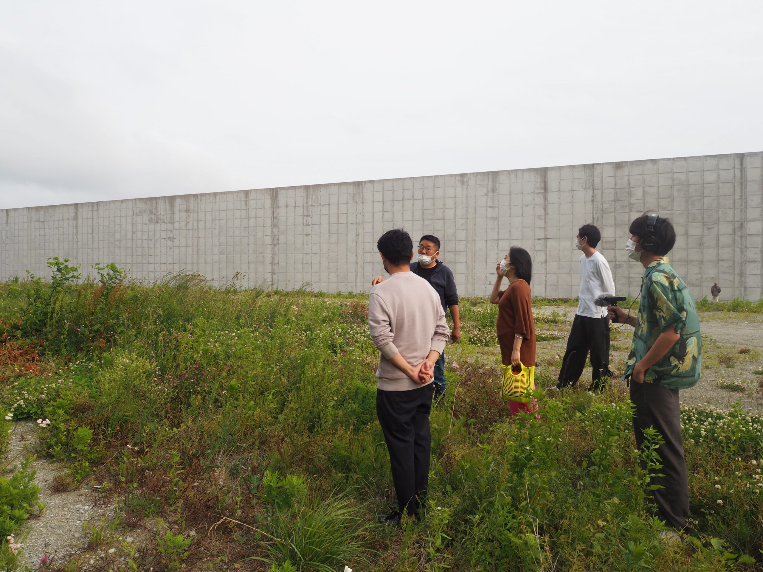
After leaving Hamanasu, we interviewed Mr. Ono again. We saw the embankment from below and above, and experienced firsthand the power of the massive wall on the border. We also learned about the city’s disaster prevention system by viewing evacuation routes and the location of high ground after the earthquake. The height of tsunamis from the Meiji Sanriku Earthquake, the Showa Sanriku Earthquake, and the 1960 Chilean Earthquake were recorded, and we experienced the horror of nature that swallowed up this beautiful town.